LiDAR, Light Detection And Ranging, là một thuật ngữ dùng trong công nghệ viễn thám, sử dụng các cảm biến laser để khảo sát đối tượng từ xa. Dữ liệu thu được của hệ thống là tập hợp đám mây điểm phản xạ 3 chiều của tia laser từ đối tượng được khảo sát.
CÁC ỨNG DỤNG CỦA CÔNG NGHỆ LIDAR
ỨNG DỤNG LIDAR TRONG LÂM NGHIỆP
LIDAR TRONG XÂY DỰNG(Lidar Application in construction)
GIÁM SÁT CÔNG TRƯỜNG XÂY DỰNG
(3D LIDAR Scanning Construction Monitoring)
CÔNG NGHỆ LIDAR TRONG CÔNG TRÌNH NGẦM
(LiDAR technology in underground Construction)
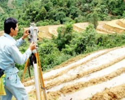
ỨNG DỤNG LIDAR TRONG NÔNG NGHIỆP
(Lidar Application in Agriculture)
ỨNG DỤNG LIDAR TRONG XÂY DỰNG DÂN DỤNG
(Lidar Applications in Civil engineering)
Individual Plant Accuracy for
Precision Farming – with LiDAR
ỨNG DỤNG LIDAR
TRONG LÂM NGHIỆP(lidar application in forestry)
Forest Applications of LiDar
UAV LIDAR for forestry application
YellowScan’s LIDAR for Drone 2016 – UAV Survey of a forest – LiDAR explained
ỨNG DỤNG LIDAR TRONG KHAI THÁC MỎ
(Lidar Application in Mining)
LiDar in Mining.Introducing Drone2Map for Arcgis
GIS ỨNG DỤNG LIDAR TRONG AUTOMOTIVE
Active sensing technologies for automotive applications
LIDAR systems for automotive:
Benefits and the challenges for OEMs
How Ford’s self-driving car uses
Velodyne LiDAR to make real-time 3D maps
Nguồn tin:Theo Văn phòng Tổng công ty tổng hợp.


 Cảm biến áp suất (Tín hiệu điện) | Model 3400


